Route through Northern Argentina

I rode into Argentina from Chile over the 4000m high Los Libertadores/Cristo Redentor pass just below Mt Aconcagua (the Andes highest mountain at~7000m elev). The border formalities are a bit confusing here as there are many buildings strung out over a few km with no clear directions – because of this, I managed to miss the Chilean exit, but I never had any comeback from that.
The environment of this part of Argentina is mostly arid rocky desert (but definitely not flat!) with exposed mountains that have very little tree cover. The elevation just keeps on rising the further north you go (3500m at the La Quiaca – Villazon border) so it’s a good area for acclimatisation with several day rides that can take you up over the 4000+m mark along the way.
I had a very apt introduction to Argentina on my second day from Uspallata to Mendoza (see highlights below).
From Mendoza I then rode north over a month to the Bolivian border.
I went via San Juan, San Jose de Jachal, Ischigualasto National Park (photo left - i was able to ride through the park following the 'tourist truck'), onto Villa Union, Jague (day trip) and Chilecito. Between Villa Union and Chilecito the Ruta 40 was actually closed for construction (one of the construction crew actually walked me through the work site to show me that it wasn’t possible to get the bike through) so that made for an interesting running out of fuel/pushing the bike/getting rescued by the police scenario back to Villa Union. After the huge detour through to Chilecito, I went on Tinogasta and the Ruinas de los Quilmas before heading into the very green Tafi del Valle, then doubling back to Cafayate on the Ruta 40.
Some of Ruta 40 looks like this below
 S
S
The 3000m high pass towards Tafi (below)

Tafi de Valle (below)

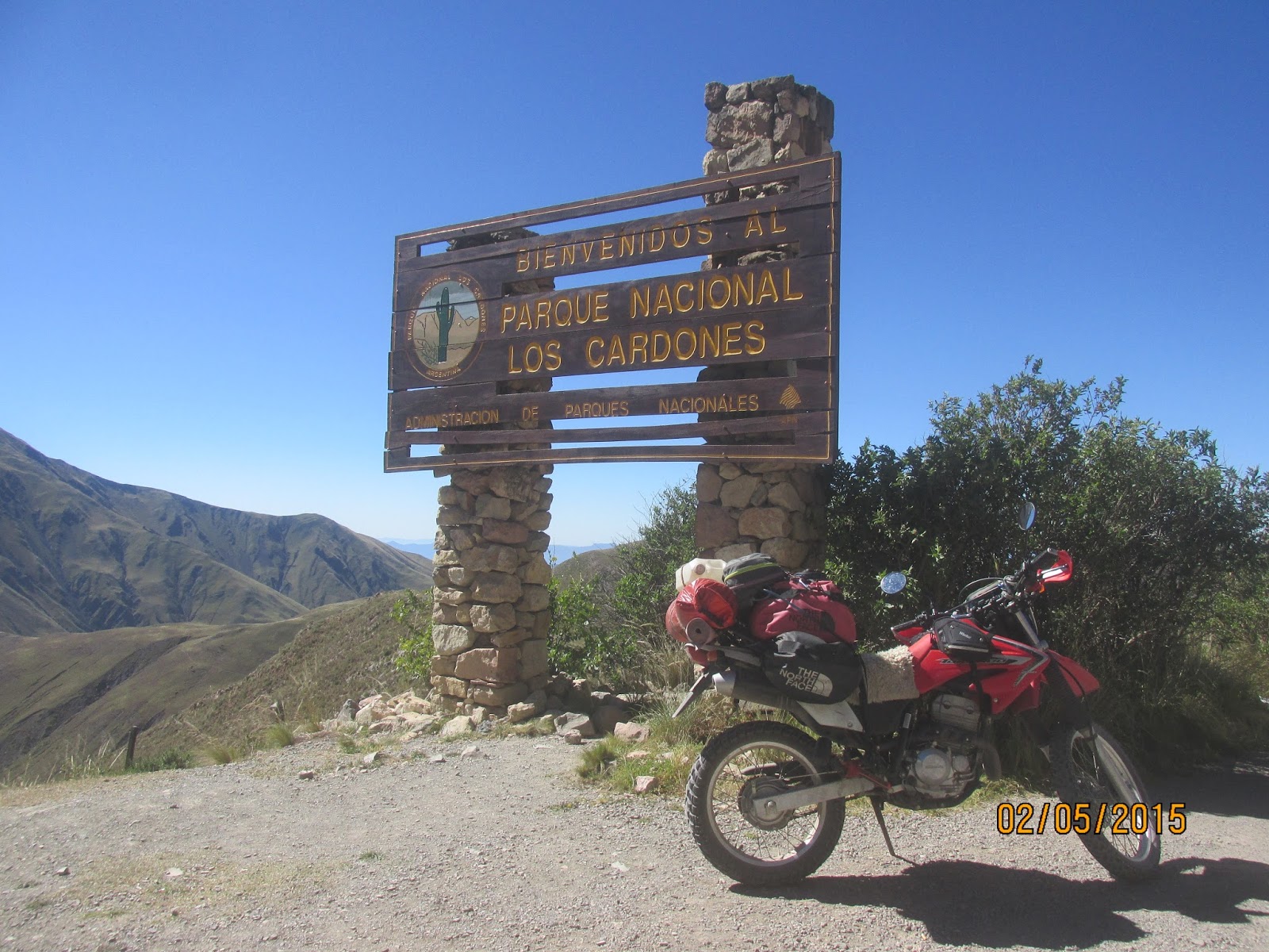
Continuing north from Cafayate, route 68 - Quebrada del Rio de las Conchas) was a stunning ride through the canyonlands to Salta. From Salta I went with the intention of riding back along Ruta 68 to Chicoanna, thorugh los Cardones National Park (see below) via Cachi and La Poma to cross the (4700m elev.) pass to San Antonion de los Cobres. Hainv stayed the night at La Poma (4350m elev.) I binned off the crossing of the high pass due to strong winds that - being alone and in such a remote area on those loose gravel roads - just didn't feel too safe.

La Poma (below)

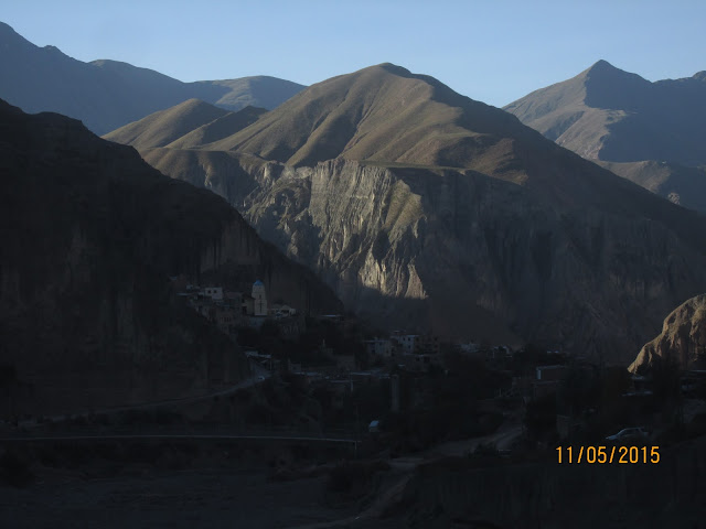
From La Poma, I doubled back to Salta (dropping to 1350m elev.) through Juju, Purnamarca, Tilcara (check out Waira hostel) and Humahuaca.

I took a few day rides from Humahuaca (Hostel Humahuaca is super cool) to Iruya (photo above) and Cerro de los 14 Colores (photo below). There is so much scope for riding here and although I spent a month (April 2014) I only touched the tip of the iceberg - its a dirt riders paradise for the wide open trails over twisty mountain roads that you can see for miles ahead, reminds me of riding on the pistes in northern Morocco.
From Humahuaca it was a simple ride to the border at La Union which is a nice and simple crossing into Bolivia.
Cerro de los 7 Colores (below)


Highlight: RP13 from Uspallata to Mendoza 1/2 day, 120km
The diary entry for the day says it all:‘Picked a good route - RP13, had no idea it would turn out to be 100% adventure ride and semi enduro style. Through red canyons and up and over and back down the rocky switchies of the steeply dipping rocks of the surrounding hills with some dry riverbed riding thrown in. Fully ladened bike too (the weight actually seems to help - apart from when im pinned out in first). 110km and saw one scooter 10km from Mendoza as I came out through farmland. Other than that I saw nobody at all. Was awesome. I was a wee bit scared!’


Highlight: Los Cardones National Park 1 day (Chicoana to Cachi, 175km, 1/2 day)

A day loop would do it – or you could stay at Cachi and make 2 days out of it if coming from elsewhere. Chicoana has a few hospedajes (see the tourist info on the main market place) to stay at too.
The RP33 heads west from the RN68, after the pass (over these green mountains on the left here), it splits off west (as the RP42) to the Ruta 40 just south of Cachi or continues north to Payagasta; take either one of these and come back the other way.


The pass at 3200m elevation


Ruta 40 towards Cachi

Heading back east on the RP42


Highlight: Humahuacato to Iruya (1 day, 140km return)


I rode out with a couple of local boys on a return ride from Humahuaca to Iruya (3900m elevation) which is an Inca village located 53km along a tierra/ripio (dirt to you and me) road off the pavimento (sealed road). There are places to stay here if so required.
‘Another fab day out of Humahuaca riding. Myself, Gus 'con mi chico moto' (his yamaha 250) and Max(imillion) on his 400 honda falcon managed to get off by noon and what a ride there and back …Amazing scenery up to 4000m’.


Iruya below


Heading back to Humahuaca

‘Another fab day out of Humahuaca riding. Myself, Gus 'con mi chico moto' (his yamaha 250) and Max(imillion) on his 400 honda falcon managed to get off by noon and what a ride there and back …Amazing scenery up to 4000m’.


Iruya below


Heading back to Humahuaca


Comments
Post a Comment